Publication
Bayesian Multi-Class Segmentation for Remote Sensing, Integrating User Priors and Uncertainty
Yeongsu Kim, Haeyun Lee, Seo-Yeon Choi, and Kyungsu Lee. "Bayesian Multi-Class Segmentation for Remote Sensing, Integrating User Priors and Uncertainty," IEEE Transactions on Geoscience and Remote Sensing (TGRS) , 2026.
Abstract
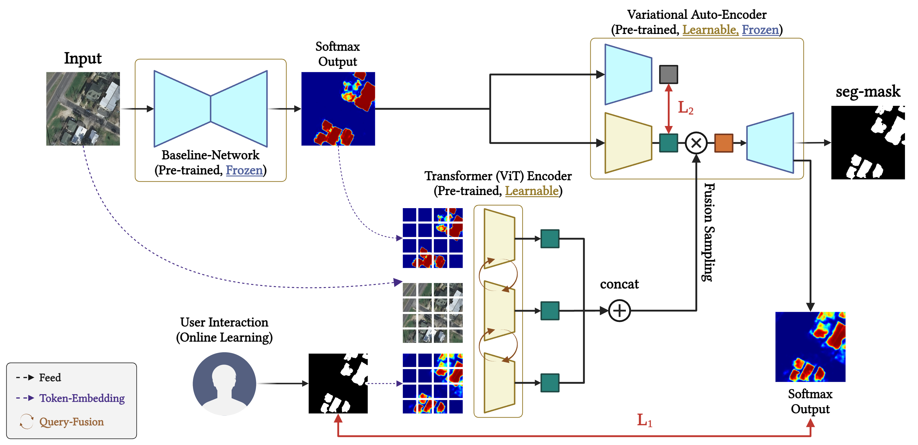
Geospatial object segmentation from aerial imagery is a significant task in remote sensing, underpinning a wide range of applications such as environmental monitoring, urban planning, and defense. Despite advances in deep learning, conventional segmentation methodologies often suffer from limited generalizability due to regional variability, data distribution shifts, and ambiguous object boundaries. Moreover, most existing approaches are based on static, pre-trained architectures with the lack of adaptability to unseen domains or user-specific requirements. To alleviate this, we introduce, in this study, a novel interactive segmentation framework that integrates few-shot semi-online adaptation with a Bayesian variational inference mechanism. Our approach dynamically incorporates user corrections and convolutional feature representations to construct an adaptive prior within a variational autoencoder, thereby enabling user knowledge and feedback to be directly encoded into the segmentation process. This probabilistic formulation enhances the iterative refinement of segmentation masks in response to user input as well as enables principled quantification of model uncertainty, which is a strong factor for trustworthy deployment in real-world geospatial applications. Extensive experiments on multiple benchmark remote sensing datasets demonstrate that our method achieves superior segmentation accuracy and robustness with minimal user intervention, outperforming existing test-time adaptation and interactive segmentation techniques. The proposed framework represents a scalable and user-adaptive solution, bridging the gap between automated segmentation and domain-expert guidance, and advancing the state of the art in geospatial analysis for heterogeneous and dynamic environments.